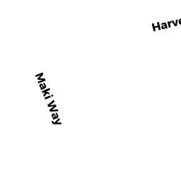
39 HARVEST CIR
Owner Information
RICHARD MARY-KATHERINE
39 HARVEST CIR
W WAREHAM, MA 02576


Property Details
39 HARVEST CIR is classified as a Single Family Residential (Colonial).
The primary structure on this property was built in 2004. There are 4,040ft2 of built area within this property. There is 2,152ft2 of residential/living space within this property. This property is listed as having 7 rooms.
39 HARVEST CIR is valued at $401,200. The land is valued at $114,400 and the structures are valued at $286,800.
This property is in Zone R60. Confirm with local Zoning Board authorities to ensure there are no overlays or other easements on this property.
The most recent deed for 39 HARVEST CIR is recorded at the local registrar in Book 53056, Page 0153. 39 HARVEST CIR was last sold on Friday, July 10, 2020 for $439,900.
Assessment data from fiscal year 2022.
Flood Data
According to the FEMA National Flood Hazard Layer, this property does not appear to be in a flood zone. It may also be in an area not yet reviewed. Nonetheless, confirm this information prior to taking any action.
To view the flood hazards around this property, create a FEMA "Firmette" Map of the area around 39 HARVEST CIR.
Broadband Internet Providers
| Provider | Type | Bandwidth (mbps) | |
|---|---|---|---|
| Verizon New England Inc. | DSL | 5 | 0 |
| Verizon New England Inc. | Fiber | 940 | 880 |
| Viasat Inc | Satellite | 35 | 3 |
| Comcast | Cable | 1000 | 35 |
| GCI Communication Corp. | Satellite | 0 | 0 |
| HughesNet | Satellite | 25 | 3 |
| VSAT Systems, LLC. | Satellite | 2 | 1 |
Broadband service provider data from December 2020.
Adjacent Properties
- 0 COUNTY RD OFF
Agricultural/Horticultural Land not included in Chapter 61A owned by EAGLE HOLT COMPANY INC - 0 SQUIRREL IS RD
Mass. Highway Dept. (MHD) (non-reimbursable) owned by COMM OF MASS - 37 HARVEST CIR
Single Family Residential owned by DUGGAN JOHN - 43 HARVEST CIR
Single Family Residential owned by ROUSSEAU GARY L - 0 TERRY LN
Improved, Selectmen or City Council (Municipal) owned by TOWN OF WAREHAM - 0 FONSECA WY
Undevelopable Residential Land owned by CORNERSTONE ESTATES 2